By: Ishita Goel J
December 2 2022

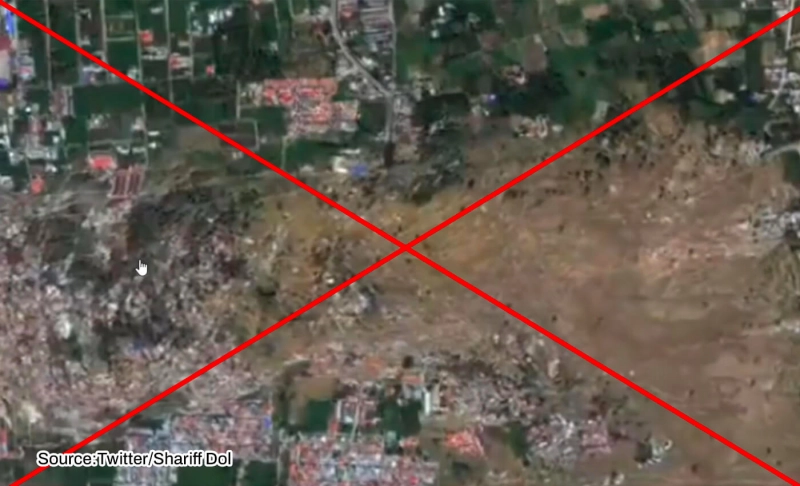
Impact of the 2018 earthquake in Indonesia captured by satellite imagery is being falsely recirculated.
Context
As an earthquake struck Indonesia on November 21, 2022, news reports and videos depicting the damages caused by the earthquake went viral on social media. One such video on social media claims to show satellite imagery of Indonesia, describing how the earthquake severely impacted a neighborhood. In the video, we can hear the narration by a person referring to themselves as Dabho 7, who explains the entire video. However, this is an old report.
In Fact
By conducting a reverse image and keyword search, we traced the video back to 2018. On October 2, 2018, Associated Press published a video on YouTube with the caption, "Satellite images show Indonesia's destruction." The released imagery was from the 7.5 magnitude earthquake that struck Palu, Indonesia, in September 2018.
CNN also posted satellite imagery from DigitalGlobe on Facebook on how an entire neighborhood and a bridge got wiped out. They linked to a report that showed before and after images from Indonesia.
"The major earthquake triggered catastrophic liquefaction, landslides, and a near-field tsunami that resulted in direct damage, impact, economic loss, and loss of life," International Tsunami Information Center noted. The three most affected areas were Donggala, Palu City, Sigi, and Parigi Moutong.
The viral video was also published by a YouTube user, "DAHBOO777 " in 2018 with the caption "Crazy! Satellite Timelapse Shows Liquefaction During Indonesia Earthquake." He credits the footage to the Jakarta Post – Asia News Network.
Clips from the viral video match the 2018 satellite imagery, showing the video is not from the recent Indonesia earthquake.
The video was used to falsely depict the impact of a 5.6-magnitude quake that struck Cianjur Regency, West Java, Indonesia, on November 21, 2022. Landslides and many houses were in rubbles in the affected area. Indonesia's Meteorology, Climatology, and Geophysical Agency (BMKG) clarified that there was no potential for a tsunami.
National Board for Disaster Management (BNPB) noted until November 24, "61,908 people have been displaced, while 22,241 houses have been seriously damaged, 11,641 moderately damaged, and 22,090 slightly damaged."
The Verdict
Old Earthquake imagery from 2018 is being recirculated as a damage report from the 2022 earthquake in West Java Province, Indonesia. Therefore, we have marked this claim as false.